- DJI Mavic 3M Multispec Worry-Free Basic Combo
-
DJI Mavic 3M - See more, work smarter
Effective aerial surveying must be able to see the invisible. For this reason, the Mavic 3 Multispectral has multiple cameras to give you multiple views. It combines an RGB camera with a multispectral camera to scan and analyze plant growth with absolute precision. Precision agriculture requires relevant details and data, and the Mavic 3M delivers both.
Compact and handy Multispectral RGB camera Safe and stable Precise positioning Efficient aerial measurement Foldable for easy storage 4x5 MP G/R/RE/NIR 20 MP 4/3 CMOS, mechanical shutter Omnidirectional obstacle avoidance
15 km transmission range
Centimeter-precise RTK positioning
Time synchronization accurate to the microsecond
Up to 200 hectares per flight Multispectral + RGB image processing system
Highly integrated image processing system
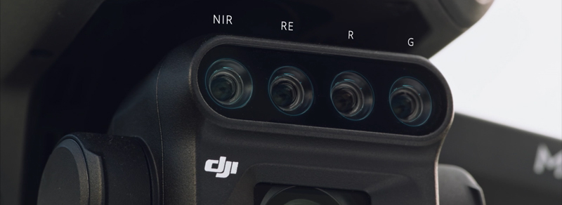
New, improved image processing system with a 20 MP RGB camera and four 5 MP multispectral cameras (green, red, red edge and near infrared). Enables applications such as high-precision aerial surveying, plant growth monitoring, and natural resource surveying.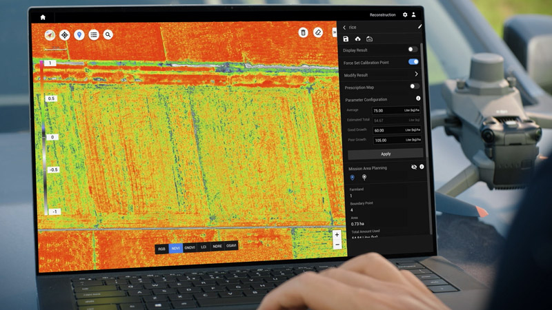
5 MP multispectral camera
- Near infrared (NIR) 860 nm ± 26 nm
- Red Edge (RE) 730nm ± 16nm
- Red ® 650 nm ± 16 nm
- Green (G) 560 nm ± 16 nm
RGB camera features
- 4/3 CMOS 20MP camera sensor
- 1/2,000s Fastest mechanical shutter speed
- 0.7s high speed continuous shooting when using RGB camera
Sunlight sensor
The integrated sunlight sensor detects solar radiation and records it in an image file, which enables light compensation of image data during 2D reconstruction. This results in more accurate NDVI results as well as improved accuracy and consistency of data collected over time.RTK Module - Precise images that capture every pixel
Mavic 3M with RTK module for centimeter-accurate positioning. The flight controller, camera and RTK module are synchronized in microseconds to always accurately determine the center position of each camera shot. This enables the Mavic 3M to carry out high-precision aerial measurement without control points.Efficient and reliable battery life
Ultra-long battery life, fast continuous shooting
Up to 43 minutes of flight time200 hectares
A single flight can carry out mapping missions over an area of up to 200 hectares.Long battery life and fast charging
Battery charging station (100 W) Highly efficient fast charging capabilityFast charging with 88W aircraft
Stable signal, smooth image transmission
O3 transmission integrates two transmission signals and four reception signals to support ultra-long transmission distances of 15km.Omnidirectional obstacle avoidance, terrain-following aerial survey
The aircraft has multiple wide-angle vision sensors that accurately detect obstacles in all directions to enable omnidirectional obstacle avoidance. Terrain-following aerial surveying can easily be performed in landscapes with steep slopes.Applications
Mapping orchards
The Mavic 3M enables aerial mapping of orchards following the terrain, even in hilly landscapes. Together with the DJI Terra or DJI SmartFarm platforms, you can reconstruct high-resolution maps of orchards, automatically detect the number of trees, distinguish trees from other obstacles or objects, and create three-dimensional flight paths for agricultural drones, making operations safer and more efficient.- Mavic 3M aerial survey
- Mapping with DJI Terra / DJI SmartFarm
- Generate 3D routes
- Agricultural drone operations
Manage variable applications
For rice fertilization, cotton growth regulation and potato foliar fertilizer spraying, the Mavic 3M is used to obtain multispectral images of crops. DJI Terra or DJI SmartFarm can then generate maps with NDVI and other vegetation indices, capture differences in crop potential, and create application maps that enable agricultural drones to perform variable applications. This ultimately enables farmers to reduce costs, increase yields and protect the environment.- Mavic 3M aerial survey
- DJI SmartFarm
- Generates application maps for farmland
- Agricultural drone
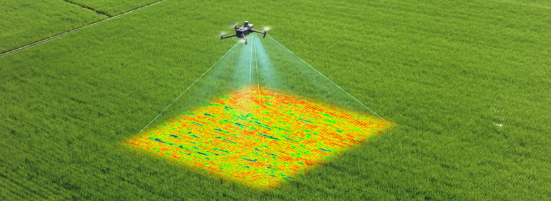
Intelligent field analysis
The Mavic 3M can perform automatic field analysis. The field analysis images can be uploaded to the DJI SmartFarm in real time via a 4G network. It can detect anomalies such as pest infestation, weed growth and deficiencies in plant development at an early stage. It can also perform intelligent analysis, e.g. Such as cotton seedling identification and rice production testing, AI identification enables real-time exchange of crop growth information, guidance of agronomic activities, and easy management of 70 hectares of farmland by one person.Environmental monitoring and natural resource surveying
The Mavic 3M can also be used in environmental monitoring and natural resource surveying, e.g. B. for monitoring water recharge, measuring forest distribution, measuring urban green spaces and more.- Monitoring of water eutrophication
- Surveying forest cover
- Surveying urban vegetation
Open ecosystem
Cloud API
The Mavic 3M can be connected to a third-party cloud platform using the MQTT protocol directly through DJI Pilot 2's built-in cloud API. There is no need to develop a standalone app to enable the transmission of drone device information, live streams, photo data and other information.MSDK
The Mavic 3M supports Mobile SDK 5 (MSDK5) with a fully open-sourced code sample. The MSDK5 is user-friendly and allows e.g. B. developing a proprietary app to conduct routine agricultural drone flights, intelligent surveying and other scenarios.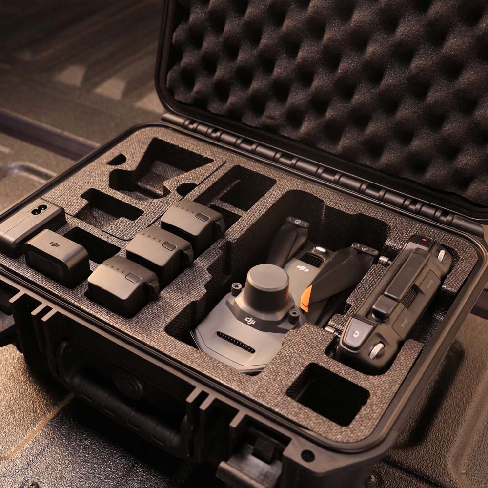
Copyright © 2024 Model Heli Services. Powered by Shopify.